Thursday, December 30, 2010

Table Rock State Park


Date: Wednesday, December 29, 2010
Map: Link
Trails: Table Rock, Carrick Creek, Pinnacle Mountain, Mill Creek Falls Spur
Distance: 6.0 miles
Time: 3 hours
Rating: 4 out of 5

My original plan was to hike the entire Jones Gap trail. I left the house at 9:30am. However, when I arrived at the entrance to Jones Gap State Park at 10:40am, I found the gate was closed. There were two other cars in front of me; one of the drivers said he had just seen the park ranger, who said the park was closed due to ice. I was disappointed, but not surprised, as about 4-6 inches of snow fell up here 3-4 days earlier. The last 2 miles of the road leading up to the park entrance was covered in ice. Oh well....

As I headed back down River Falls Road toward Hwy 11, I decided to go to Table Rock State Park instead. I could have tried Caesar's Head State Park, which also has access to the Jones Gap Trail. But as it is even further up into the mountains, I thought it might be closed due to ice as well. And, I would really prefer to hike the 5.3-mile trail starting from the Jones Gap trailhead, which allows for climbing on the way out, and descending on the way back.

It took me another 30 minutes to drive to Table Rock, turning right (south) onto Hwy 11. I arrived at 11:10am. By 11:20am I was on the trail. I decided I would go to Mill Creeks Falls, via the Pinnacle Mountain Trail. Basically, from the trailhead, I followed the Table Rock Trail to the first junction after the bridge, then turned left onto the Carrick Creek Trail, and stayed left onto the Pinnacle Mountain Trail. All trails are clearly blazed, and every half-mile is marked.

There was snow still on the ground, as evident in the photos. It was obviously thicker at higher elevations and in the more shady areas. Some parts of the trail were completely clear of ice and snow. But in many others, I had to walk through snow. There were other footprints already there, making it very easy to follow. In places where I had to cross streams on rocks or footbridges, the footing was a little treacherous, but otherwise I did not have too much trouble.
The Pinnacle Mountain trail weaves along hillsides as it gains elevation. Eventually, you'll see large boulders, followed by some large rocky overhangs. Beyond that, there are some stream-crossings over rocks. Finally, at about 2.6 miles, you'll come to a junction. Turning right lets you continue on the Pinnacle Mountain trail. I stayed left onto the Mill Creek Falls Spur trail, which is another 0.4 miles to the falls. This was probably the most "rugged" part of the hike. It really feels like you need to use both arms in addition to your legs, as there is a lot of scrambling over rocks and downed trees, and constant steep ups-and-downs. The snow/ice certainly added to the level of difficulty. Again, though, my hiking pole helped a lot.
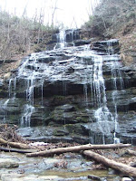
At 1:00pm, I reached the falls and took photos. It was quite a sight seeing the waterfall frosted around the edges. In fact, I think this was the first time I've ever hiked in accumulated snow. There is a bridge that crosses in front of the waterfall, which allows a good view, but the trail no longer continues on the other side. On warmer days, I have sat on the bridge here and had a snack. But today there were about 4 inches of snow on the bridge. So I just stood there for awhile before turning around.
The return trip was much easier due to it being mostly downhill, and a little quicker. Upon joining up with the Carrick Creek Trail again, I turned left so that I could complete the full clockwise loop. I finally arrived back at the parking lot at 2:20pm and headed home. It was a little cold (in the 40's) but not bad, and a very enjoyable hike with all the snow!
Thursday, December 23, 2010

Station Cove Falls


Date: Tuesday, December 21, 2010
Map: Link
Trails: Station Cove Falls, Oconee Connector
Distance: 4.5 miles
Time: 1 hour 40 minutes
Rating: 3 out of 5

Once Kerri returned from running, I went up to Oconee Station State Historic Site for a hike. It was about 2:20pm when I left, and I arrived at 3:00pm. I just headed up Highway 28 from Seneca, then took Highway 11 north. At the brown park sign I turned left, and the entrance to the SHS is a few miles ahead on the right. Unfortunately the gate was closed. I'm not sure why, unless it is just closed for the winter. There was no sign posted to explain the reason. Anyway, no big deal in this case. I just continued a couple hundred yards further down the road and parked at the trailhead for Station Cove Falls and the Oconee Connector of the Palmetto Trail.

There were no other cars in the lot. It was cold and overcast. I started on the Station Cove Falls trail, which runs concurrent with the Oconee Connector. There are yellow blazes on the trees...very easy to follow. I followed the path over a couple of bridges to a hiker gate after about a half mile. I went through the gate, and in another quarter mile or so, there is a stream crossing and the falls are in view. I reached the falls in about 17 minutes without stopping. Not much water in the falls today, but then it hasn't rained much lately.
I stayed here for a few minutes, took some pictures and had a snack before turning around and heading back to the hiker gate. Here, I decided to turn left where the Oconee Connector leaves the Station Cove Falls trail, and heads uphill toward its other terminus at Oconee State Park.

This is really a very nice trail, better than I had expected. It moves steeply and relentlessly uphill with switchbacks, to a ridgeline. Once on the ridgeline, the terrain looks very much like Oconee State Park (mountain laurel everywhere). There are some views through the trees on both sides of the trail, with the best ones off to the right. As I approached the ridge, it started to rain lightly, but I had come prepared with a rain jacket. I also had my hiking pole, which helped a lot with the uphill climb over wet leaves.

At each mile along the trail, there are signposts, with a mile number representing how far you've come from the trailhead you left. I passed Mile 1, and then I came to another marker that had Mile 2 showing on the opposite side, meaning that I was still two miles from the other trailhead. I stopped at this marker, and returned back the way I had come, in the interest of time. By my estimate, I hiked about a mile and half on the Oconee Connector after leaving the Station Cove Falls trail, although I can't really line that up with the posted mile markers.
I returned to the car at about 4:40pm. A very enjoyable hike, and I really had a good time on the Oconee Connector. I would be interested in doing the whole trail at some point in the future, if I'll allow more time for it. Even though it is a slightly longer drive, I decided to head home by continuing north on Hwy 11 and turning right onto Hwy 133 to Clemson. This was a more relaxing drive than going through Seneca at 5pm on a weekday before Christmas.

Monday, December 13, 2010

Oconee State Park


Date: Sunday, December 12, 2010
Map: Link
Trails: Foothills, Tamassee Knob
Distance: 4.2 miles
Time: 1 hour 45 minutes
Rating: 4 out of 5

With the forecast calling for temperatures in the 30's and 20mph winds (but no precipitation), I went to Oconee State Park for a hike. It took about 45 minutes to get there from my house. From Seneca, I took Hwy 28 north through Walhalla, and stayed right onto Hwy 107 to the park entrance. As I got to Walhalla, the snow flurries started, and I noticed that cars coming down out of the mountains had 2-3 inches of snow on them. I watched my car's thermometer drop from 43F to 33F over the course of the trip.

The flurries were still falling as I started on the Foothills trail from the parking lot. In fact, there was actually snow accumulated on the ground. In many places the trail was completely covered, although it was never difficult to make out the path. I got started about 2:10pm. The skies were overcast. Not the best conditions for hiking, but I had on a really warm fleece pullover, and hat/gloves, so I was really comfortable the whole time.

After maybe 10 minutes the path crosses over the Palmetto Trail and then hits the junction with the Tamassee Knob trail (i.e., turn right). The terrain is mostly gentle ups and downs, with the path sometimes winding around hillsides on narrow paths. There was one spot that was a little treacherous due to the snow, and I was glad to have a hiking pole with me. Beyond this point, it seemed that either not as much snow had fallen, or it had mostly melted.

At around 25-30 minutes, I reached the "saddle" between two mountains, with great views on both sides. There was almost no snow on the ground here. In the distance, I could see the valley floor being lit up in places by the sun breaking through the clouds. This was really an incredible sight; the snow made it look like parts of the valley were glowing. I don't think my pictures really do it justice, and it is difficult to describe.

Beyond the "saddle", there is a pretty steep climb up to Tamassee Knob. I reached the overlook (and the end of the trail) in about 45 minutes. After a 10 minute break to take some photos and eat some snacks, I headed back. While I was up there, though, the skies really started clearing, and the wind was really blowing hard. The whole scene was spectacular.

I headed back the way I had come, and returned to the car about 3:55pm. Amazingly, despite the sunshine at Tamassee Knob, the conditions at my car were exactly the same as when I had left: overcast with snow flurries.

I think that normally this trail would get a "3-star" rating. However, the combination of unique weather conditions and great scenery absolutely made this a 4-star hike!

Saturday, December 4, 2010

Yellow Branch Falls


Date: Saturday, December 4, 2010
Map: Link
Trails: Yellow Branch Nature, Yellow Branch Falls
Distance: 3.0 miles
Time: 1 hour 30 minutes
Rating: 3 out of 5

On Saturday morning I headed to the Yellow Branch picnic area north of Walhalla on Hwy 28. It only took me 35 minutes to get there from my house. This is one of my most favorite places to hike. The weather was overcast and cold, in the lower 40's. More "gloomy" weather. When I arrived, mine was the only car in the parking lot, but a couple more cars arrived after me.

I started on the Nature trail from the parking lot. There are 3 stream crossings, then a turnoff onto the Falls trail. There is a bridge, and then another stream crossing. After this, the trail leaves the stream. There are two more footbridges, and you will comes to the Falls about 15 minutes after crossing that second bridge.

The water volume in the falls was pretty low, but really it is never a disappointment when you get here. I crossed in front of the cascade to a well-worn bench and took a rest there for a few minutes. Very relaxing.

I headed back to the parking lot the way I came, except I turned right at the junction with the Nature trail to finish out that loop. I was moving a little slowly today; I had started at 10:30am, and returned at 12:00 noon.

Yellow Branch Falls is always a good option for a hike in this area!

Friday, November 26, 2010

Devils Fork State Park


Date: Friday, November 26, 2010
Map: Link
Trails: Bear Cove, Oconee Bells
Distance: 3.0 miles
Time: 1 hour 30 minutes
Rating: 3 out of 5

The Friday after Thanksgiving, I headed out to Devils Fork State Park. The weather was cool and overcast ("gloomy"). At least it had stopped raining. I went up Hwy 133 and turned left onto Hwy 11, then followed the brown park signs to the entrance. I paid the $2 fee and parked at the trailhead for Bear Cove. It took about 45 minutes to get here from the house.

I started hiking around 2:30. I soon realized it would be difficult to stay on the trail, as the path was entirely obscured by newly fallen leaves. Luckily there are blazes frequently marked on trees along the trails. Personally I think white is a poor color choice for a blaze, since many trees have white marks on them naturally. At least they were marked, though, and the trails appear to be very well-maintained.

After moving through mostly oak, hickory, and pine forest, as the trail reaches a peninsula jutting out into Lake Jocassee, the forest becomes dense with mountain laurel. Really, this is my favorite feature of this trail. There are a couple of spots where you can easily access sand beaches, which is very nice in the summer.

Completing the loop and returning back to the car, I decided to drive over to the other trail, the Oconee Bells Nature trail. It is a 1-mile loop, and I got started at 3:30. Although short, this is a really great trail. There is so much to see in a short distance: bridges, streams, narrow twisting trails, a bog/pond, a small waterfall, rocky overhangs, and the namesake Oconee Bells themselves.

If you look at the photo above, the green groundcover along the banks of the stream is the Oconee Bells plant. Up close, the leaves look like a kind of ivy with jagged edges. In early spring, it blooms. It is very rare, and this is one of the few places it grows.

I returned to the car at 4:00pm. Despite the gloomy weather, an enjoyable hike.

Table Rock State Park


Date: Sunday, November 21, 2010
Map: Link
Trails: Table Rock, Carrick Creek, Pinnacle Mountain
Distance: 3.5 miles
Time: 1 hour 15 minutes
Rating: 3 out of 5

Another Sunday-after-church hike. The weather was nice, and I decided to head up to Table Rock State Park. I drove up Hwy 133 and turned right onto Hwy 11. It takes about 50 minutes from my house.

Because the weather was so nice (sunny, low 70's), it was pretty busy at the park. I saw a lot of people in the parking area, and around the visitors center. There is a new viewing platform along the paved portion of the Table Rock trail, so people can get a look at one of the waterfalls.

I started on the Table Rock trail about 1:50pm. I turned left onto the Carrick Creek trail. At the next junction, I stayed left onto the Pinnacle Mountain trail. My original thought was to go all the way to Mill Creek Falls, but I decided I didn't have enough time for that. So I just decided to hike out as far as I could before having to turn around, so I could make it home by 4pm.

There are some (new?) mileage markers on the Pinnacle Mountain trail. Just after leaving the Carrick Creek trail, I saw the 1.0 marker. Then I came to a series of low bridges, and soon saw the 1.5 marker. This is where I took some photos and turned around. I finished out the Carrick Creek loop and returned to the parking lot about 2:05pm. A great hike on a beautiful fall day.

Keowee-Toxaway State Park


Date: Sunday, November 14, 2010
Map: Link
Trails: Natural Bridge, Raven Rock
Distance: 4.0 miles
Time: 1 hour 30 minutes
Rating: 3 out of 5

After church, I headed up Hwy 133 for a hike at Keowee-Toxaway State Park. It is only a 30 minute drive from our house. I started on the trail about 1:30pm. It was cool, but I decided to wear shorts.

I took both the Natural Bridge and Raven Rock trails in a counter-clockwise direction. This is the way the trail signs seem to direct you, although the last stretch up the Natural Bridge trail returning to the parking lot is very steep. I did skip the short north loop that goes down to the lake, as it is ridiculously steep.

It was a nice hike. I just saw a few people on the Natural Bridge trail, no one at all on the Raven Rock trail. Some leaves were still on the trees, and there was some nice color here and there. I got back to the car around 3:00pm. A very enjoyable hike!

Monday, October 18, 2010

Keowee-Toxaway State Park


Date: Sunday, October 17, 2010
Map: Link
Trails: Natural Bridge
Distance: 1.5 miles
Time: 30 minutes
Rating: 3 out of 5

On a cool fall afternoon, I decided to do a quick hike while the kids were napping / having quiet time. The leaves are just on the verge of changing colors. It was a nice drive up Hwy 133 to the park.

I arrived about 2:40pm (it is only a 30 minute drive) and started on the Natural Bridge loop trail from the parking lot. I saw a couple of other groups, but it was definitely not crowded on the trail. I took the loop in a clockwise direction, which allows you to take the steepest part of the trail going downhill rather than uphill.

I got back to the car in only 30 minutes! I wasn't trying to race through the trail, but I kept a pretty quick pace, and only stopped for a couple of minutes at the river crossing. A nice hike overall.

Sunday, October 3, 2010

Pinckney Island National Wildlife Refuge


Date: Friday, October 1, 2010
Map: Link
Trails: Pinckney Island
Distance: 5.2 miles
Time: 2 hours
Rating: 4 out of 5

Kerri and I were on vacation for our anniversary at Hilton Head Island. I tried not to put too much on the itinerary :-), but I did want to try a hike at Pinckney Island. You can't miss it when you go to Hilton Head...it is right off of US-278, as soon as you cross the bridge over to the the island.

It was a beatiful sunny day, with the temperature around 75 degrees. Perfect for hiking, really. I arrived and parked about 2:45 pm. The trail leaves from the parking lot on a gravel road. There is a nice posted trail map, and they have some maps to take with you as well. There are also lots of nice interpretive signs along the way.

Right after getting on the trail, you'll notice the wildlife. There are TONS of white ibis here. The trail comes quickly out of the trees and there is marshland on both sides. A lot of other people were out hiking here as well. The trail is so flat; I saw a few bikes, too.
I continued past the Ibis Pond. After 0.9 miles there is a turnoff on the right, which is a grass trail. I stayed on the gravel road past the Starr Pond ("Wood Stork Pond"), and then past Osprey Pond. I can't say I was able to identify any birds other than White Ibis, though.

Somewhere in this area, I saw an armadillo. They are hard to miss, actually. They make a lot of noise rooting around in the brush, and don't seem the slightest bit wary of humans. I took a picture; and yes, I really was that close to the armadillo!
Past the Osprey Pond, there was a 4-way junction, with a bench. I stopped there and had a snack, then turned right (south) onto the grass trail, toward Shell Point. I stayed on this path, past one turnoff on the right, all the way until it ended on a very small island. This trail passed through some pretty dense palmetto / pine forest.

Returning the way I had come, I passed a low point in the trail with a pond on each side. I noticed an alligator sitting there in the pond, and got a (quick!) picture before moving along.
At the next junction, I turned left onto another grass trail, and soon spotted my second armadillo of the day. Really, I didn't know that armadillos lived this far east. I passed Starr Pond (on my right), and finally returned to the junction with the main gravel road. I turned left and returned to the parking lot. A great hike, and a fantastic place for viewing wildlife!

Monday, July 5, 2010

Edisto Beach State Park


Date: Wednesday, June 30, 2010
Map: Link
Trails: Spanish Mount
Distance: 3.4 miles
Time: 1 hour 20 minutes
Rating: 3 out of 5

A day after doing a short hike with the kids, I was back at Edisto Beach State Park by myself, for a longer hike. I headed out in the early afternoon, and I was on the trail at 1:30. My plan was to do just the Spanish Mount trail all the way to the end and come back the same way. It is 1.7 miles one-way.

The trail is a nice, wide, flat, sandy path. It is mostly under thick tree cover. But in one spot it crosses marsh land. The picture at the top of this post shows the boardwalk here. There were lots of little crabs scurrying across the mud and through the grass, making a 'tick, tick' sound. Besides the crabs, I also saw a few lizards on this trail, and a couple of cardinals. And, I had a run-in with some (biting) black ants when I stopped to read one of the posted trail maps.
Past the boardwalk, the trail goes more into palmetto trees (our state tree!). There are several junctions with other short trails along the way. There are nice posted maps at each junction, and there are benches along the way. At the end of the trail, you have reached Scott Creek. There is an interpretive sign here, and a nice new platform that offers great views of the creek and surrounding marsh land, as well as a 4,000 year old shell mound.
I took some pictures, had a snack, and returned the way I came. It was pretty hot, but here it can be much worse. I know it is very buggy on this trail, but I used some Deepwoods OFF and had no trouble. The sand did get in my shoes, which ended up giving me a blister, but I would not have had that problem with my usual hiking boots. A very nice trail and a good hike!

Sunday, July 4, 2010

Edisto Beach State Park


Date: Tuesday, June 29, 2010
Map: Link
Trails: Spanish Mount, Forest Loop
Distance: 0.5 miles
Time: about 1 hour
Rating: 2 out of 5

We were at Edisto Beach for the week with the cousins; 5 kids under 5 years old! After a couple of days of beach time, we decided to take the kids out for a different activity. Kerri and I had hiked the trails at Edisto Beach State Park years ago. We settled on a short hike and drove back up Hwy 174 to the park entrance on Tuesday afternoon.

There is a $5 per person fee, but at least the kids were free. The Spanish Mount trail leaves from the tree-covered parking lot. It is a wide, flat, sandy path, lined with oak trees at the start. Very soon the Forest Loop trail splits off to the right. This path looks much the same, except maybe there are more pine trees here. After completing the Forest Loop trail, we turned left at the intersection with the Spanish Mount trail and headed back to the car.

The kids really enjoyed looking for trail markers (blazes on the trees) and reading the posted maps. They raced for awhile, but James and Andy soon were riding on shoulders. There are some benches along the way; a good opportunity to take a water / snack break. Despite a little crying, it was a pretty successful outing!

Tuesday, June 22, 2010

Big Bend


Date: Sunday, June 20, 2010
Map: Link
Trails: Big Bend, Chattooga
Distance: 7.4 miles
Time: 3 hours 50 minutes
Rating: 3 out of 5

It is becoming a tradition that on Father's Day every year I go for an "all-day" hike. Last year I went to Table Rock and did the whole 10-mile loop with Pinnacle mountain. I wasn't so ambitious this year, but I did want to try a trail I had never done before. I settled on Big Bend. This is a trail that leads from Hwy 107 in Oconee County near the Cherry Hill campground, over to the Chattooga River.

Maybe it is saying something about our weather pattern the last two years, but Father's Day is around the first official day of summer, and both years it was 97-98 degrees for a high temperature. But we did have beautiful clear blue skies! I left the house about 9:15am and parked in the dirt lot just south of the Cherry Hill entrance around 10:00am. Leaving this dirt lot, look across the road and to the left, and you'll see the (well-hidden) entrance to the Big Bend Trail. It quickly disappears downhill into a dense forest.

The Big Bend trail is 2.7 miles long. At least, that is what is posted on the signs, so that is what I will go by. It travels on a path covered with pine needles and edged by ferns, near two streams, across several footbridges, and parallels a dirt road for a portion of its length. As I was "early and tall," I got to knock down tons of spider webs. I don't mind that as long as the spider isn't right there in the middle of the web! I ended up using my hiking pole to knock them down, just continuously sweeping it in front of me while I walked. This was exceedingly effective. As for other wildlife, I did see this turtle:
The Big Bend Trail roughly parallels a dirt road (Big Bend Road) for awhile, before leaving it altogether. The path cuts in-and-out of several ravines, and at one point crosses what appears to be an old Forest Service road. Beyond this, you will eventually notice that the trail, which had been more or less flat to this point, begins moving generally downhill. There are a couple of footbridges over a small stream, and a sign post (one of few trail markers) lets you know the direction to follow. From, here, the trail follows the stream down to the intersection with the Foothills / Chattooga Trail and the Chattooga River.

Reaching the intersection, bear left (basically straight). The intersection is well-marked, though. Turning right would put you heading north along the Chattooga, but I wanted to go south to check out Big Bend Falls. The sound of the river is incredible. There are some rock-cliff overhangs on the trail, and the river can be seen through the trees below. The Chattooga trail winds above the river for awhile, eventually coming to a spot where you can go out to the water (maybe this is about a quarter-mile past the Big Bend Trail intersection). There is a small waterfall here; see the picture at the top. I sat on the rocks here and had a snack, watching the falls for awhile.
Beyond this, at 0.6 miles beyond the turnoff, there is supposed to be a view of the Big Bend Falls from a cliff high above the river. Well, I hiked AT LEAST 1 mile beyond the turnoff, and I caught some glimpses through the trees of what I believe had to be Big Bend Falls (the sound was certainly thunderous). But there is NOT a clear view of the falls in the summer. Maybe in winter I will have to try again!

I returned to the car the way I came; it was a little before 2pm. Really this was a very enjoyable hike. Despite not getting a clear view of Big Bend Falls, just being able to see the Chattooga River made it worthwhile. And I was pleasantly surprised by the Big Bend Trail itself. This is a very isolated location; I only saw 2 people the whole time, and both of them were on the Chattooga Trail.

Saturday, June 5, 2010

Devils Fork State Park


Date: Saturday, June 5, 2010
Map: Link
Trails: Oconee Bells Nature
Distance: 1 mile
Time: 1 hour
Rating: 3 out of 5

On a nice Saturday morning, we headed to Devils Fork State Park. From Clemson, we took Hwy 133 north and turned left onto Hwy 11. From there we followed the brown park signs to the park. We arrived around 10:45am and it was already a busy place. Our plan was to hike the 1-mile Oconee Bells Nature loop trail, followed by some swimming in Lake Jocassee and a picnic lunch. There was nowhere to park next to the trail head (lots of boat traffic), so I dropped Kerri and the kids off and parked over next to the pavilion and Bear Cove trailhead instead.

The trail goes into full tree cover right away, and heads downhill. We took the left fork (i.e., clockwise on the loop) and soon reached the "bottom." There were several nice bridges to cross, and a meandering stream. I'm not so good at identifying trees, but I know there was lots of mountain laurel, sourwood, oak and hickory. There are a couple of nice signs along the way, identifying plant life. There was also a rather large pond that we passed, and a couple of small waterfalls.

Just past the pond was a nice bench, and we took a break here. I got a photo of the kids. They look very excited in the picture, but maybe this doesn't accurately represent their general mood on this hike. Kerri and I had to carry them most of the way. Basically, they just wanted to go swimming (James) and eat lunch (Andy). The trail seemed a little longer than 1 mile, and with lots of ups-and-downs, it is not a particularly easy trail. But overall, the kids did pretty well.
Near the end, I scouted ahead to see how much of the trail was left. It turned out just to be a few more minutes, and we all returned to the parking lot, and went swimming in the lake!

Friday, June 4, 2010

Oconee Station State Historic Site


Date: Saturday, May 29, 2010
Map: Link
Trails: Oconee Station, Station Cove Falls
Distance: 3 miles
Time: 1 hour 40 minutes
Rating: 3 out of 5

On Saturday afternoon of Memorial Day weekend, I headed up to Oconee Station State Historic Site. It was only a 37 minute drive from the house. To get there take Hwy 11 north from West Union and turn left at the brown park sign onto Station Cove Road. I like to park at the SHS parking area, but there is also an unpaved lot ahead that is a little closer to the falls. There is no required fee either way.

I arrived around 2:20 pm and started hiking on the Oconee Station trail. After 10-15 minutes, this trail (staying on the near side of the pond) reaches the road. Crossing over the road, I was now on the Station Cove Falls trail. You know you are getting close to the falls when you go through a hiker gate. It is hard to describe this area, but in the spring it is always so beautiful here, and peaceful. The trees are huge, and there is a stream running over rocks through the area. The falls make quite an impression as you first see them through the trees. I arrived here after about a 35 minute hike, took some pictures, and talked with some fellow hikers for awhile.
Heading back, I thought I would take the other fork on the Oconee Station trail around the far side of the pond. However, I soon found it to be too overgrown and hard to follow, so I back-tracked, and went back to the car the same way I had gone out. I probably could have done this trail in about an hour and 15 minutes if I had been more on-task. Regardless, a good hike!

Whiteside Mountain


Date: Sunday, May 23, 2010

Map: Link
Trails: Whiteside Mountain
Distance: 2 miles
Time: 1 hour
Rating: 4 out of 5

On our Highlands weekend vacation, this was our second trip to Whiteside Mountain. The first time, it was a little too foggy to see the views. The weather had cleared significantly overnight, and Sunday morning was absolutely beautiful. So we got a little bit earlier start and arrived at the trailhead around 9:30am.

This time we decided to turn right at the fork and take the loop counter-clockwise. Honestly, I'm not sure which direction I liked better. Probably this way, as you get all the climbing out of the way after about 15-20 minutes, and everything after that is either fairly flat or a gentle downhill.
As you can see in the photos, the views today were were much better. We even saw a peregrine falcon in flight below us. We returned to the car in about an hour, and went back to the condo to pack up and head home from a great vacation!

Thursday, June 3, 2010

Sunset Rock


Date: Saturday, May 22, 2010
Map: n/a
Trails: Sunset Rock
Distance: 1.2 miles
Time: 45 minutes
Rating: 3 out of 5

We returned to the condo after hiking Glen Falls. But it was only about 2 in the afternoon, so I decided to go find another trail. There is actually a trail in Highlands itself. If you take Main Street until it becomes Horse Cove Road, you will see the Nature Center on the left. Park on the right, and a gravel road leads uphill from there. This is the trail that leads up to Sunset Rock, and it is about 0.6 miles long.

At the top of a gradual climb, turn right and soon there is a clearing. There is a natural rock amphitheater here, facing West (obviously), with views of the town below. I spent a few minutes here, then returned to the main trail. On the other side of the gravel road is a less-used path that leads to Sunrise Rock. I took this, and again after a short distance there is a clearing. Beautiful views on this side as well!
I returned to the car after an easy downhill walk, and took a quick look around the Nature Center, before heading back to the condo.

Monday, May 31, 2010

Glen Falls


Date: Saturday, May 22, 2010
Map: n/a
Trails: Glen Falls
Distance: 2 miles
Time: 1 hour 15 minutes
Rating: 3 out of 5

After leaving Whiteside Mountain, Kerri and I were ready for another hike. We decided to go see a waterfall, so we took the short drive from Highlands to Glen Falls. From town, we took Hwy 106 south for about 2 miles. A sign points the way to a gravel road on the left. At the end of the road is a parking area. According to guidebooks I've seen, the trail is supposedly 1 mile long, which seems to be accurate.

After a couple of minutes there is a clearing in the trees with views of a valley and mountains in the distance. Past that, the trail comes near the river and starts descending. There is a small viewing platform and railing next to a "water slide" over the rocks. I knew there were 3 falls on this trail, and I thought this might be counted as the first, although that turned out not to be the case.
A few minutes later, we came to the first of the 3 falls, which turned out to be a spectacular sight (see photo at the top). After this, the trail became steeper and came to the 2nd waterfall.
The switchbacks continued and became even steeper, until reaching the 3rd and final waterfall.
At this spot, I took my shoes off and waded into the pool of water at the base of the falls. Very COLD!We met a nice family from Westminster and talked for a little while. Then we returned to the car. Certainly a rewarding hike!

Whiteside Mountain


Date: Saturday, May 22, 2010
Map: Link
Trails: Whiteside Mountain
Distance: 2 miles
Time: 1 hour 15 minutes
Rating: 3 out of 5

Kerri and I were on a much-anticipated weekend vacation (sans kiddos) to Highlands. We had very little on the agenda, but we definitely wanted to get out and do some hiking. Highlands is located on the eastern continental divide, elevation 4,000-5,000 feet in western North Carolina. There are several great hiking spots all within about 15 minutes' drive from town. Ask anyone who lives there or has been there to list out a few places to go, and Whiteside Mountain will be near the top of the list.


It is a short trail, but I was trying not to be too ambitious. Because of the sweeping vistas this trail offers (usually, read on for explanation) we decided to get this one in first. The weather had been rainy, but clearing. We took US-64 east out of town, turned right at the brown park service sign onto Whiteside Mountain Road, and parked in the gravel lot at the end. We arrived at about 10:30 and the lot was nearly full.

The skies were a little cloudy, although plenty of blue could be seen. It was a little chilly with the wind blowing, probably upper 60's to low 70's. Leaving the parking lot, there is a short uphill leg before this 2-mile loop trail splits. You can take it either clockwise or counter-clockwise. We chose the former, which starts on an old roadbed. This is a wide path, gently sloping. There isn't much of a view on this side of the mountain, as there is a lot of tree cover. But the gradual slope provides a good warmup.

At the end of the long incline, the trail comes out into the open. There would be some great views here, except that today we were in the middle of a heavy fog bank. So...we couldn't see much of anything at all!

There is an overlook for watching peregrine falcons, but if there were any out there, it was too foggy to see them. We continued on, and the path continued over exposed rock. This is right next to the edge of a sheer cliff, but there are railings. After awhile, the fog began to clear.

After leaving the face of the mountain, the trail descends steeply. There are steps and bridges to help. We returned to the car about 12 noon, and ate lunch (from Mountain Fresh grocery store) at the picnic tables at the end of the parking lot. Overall, a good hike, and we were lucky the fog cleared enough for us to see the views!

Wednesday, April 7, 2010

Yellow Branch Falls


Date: Wednesday, April 7, 2010
Map: Link
Trails: Nature, Falls
Distance: 3 miles
Time: 1 hour 20 minutes
Rating: 3 out of 5

First I have to admit that this picture is a stock photo because I forgot my camera. This one was actually taken about a year ago. With that out of the way...I headed to Yellow Branch after work today and started hiking about 4:20pm. It was warm, around 80F, and partly cloudy.

This was my second time using my new hiking pole, and I guess I'm getting used to it now. It does make the hills a lot easier, and it is nice to have when crossing streams on slippery rocks. I took the Nature trail from the parking lot to the junction with the Falls trail. I noticed a LOT of trees down. I'm guessing the drought of the last 10 years (over now) is still showing it's effects. But the Forest Service has kept the trail mostly clear; I only had to climb over or under trees 5 or 6 times.

There are 3 bridges on the Falls trail. You cross the 1st one right away, then come to a stream crossing. When you reach the 3rd bridge you know you're about 15 minutes from the waterfall. Being early Spring, the leaves are still coming on the trees, so you can still see pretty far through the forest and some of the ridgeline in the distance.


I heard the waterfall long before I could see it. As you approach the falls, the temperature drops noticeably. I was amazed at the difference in the appearance of the falls since the last time I was here. Certainly, it looks like it did a few years ago, as far as the volume of water. I sat on a rock at the base of the falls for a few minutes before heading back.

I passed just two groups of people on the trails. As for wildlife, I saw two lizards and a large black beetle. Once I got back to the Nature trail, I turned right to complete the loop and headed back to my car on the road. A nice mid-week hike!


Sunday, April 4, 2010

Eastatoe Creek Heritage Preserve


Date: Saturday, April 3, 2010
Map:
Link
Trails: Eastatoe
Distance: ~5 miles
Time: 2 hours 40 minutes
Rating: 4 out of 5

I had been interested in getting here for a hike since I read about it in a guide book 3 years ago. Finally I made it, and I'd say it was worth the wait. To say this trail is in a remote location is an understatement. I left from Seneca and it took me about an hour to get there. You have to go up US-178 from Pickens and cross over Hwy 11. Pass Bob's Place on the left and the road ascends steeply up the mountain. The road will flatten out and generally start descending into a big valley. Then look for the community of Rocky Bottom (there is a sign). A mile past that, there is a bridge over the Eastatoe Creek, and you take an immediate left past the bridge. You'll see two forks; take the right fork (it is unpaved). At this point you're probably thinking (as I was) what did I get myself into and why didn't I bring the SUV with the high ground clearance instead of the VW. But a short distance later, I saw the well-marked Foothills Trail parking lot on the left and I knew I was in the right place.

I parked in the FT lot, even though the gate beyond it was open and I could probably have just driven the additional 0.1 mile up the road (Horsepasture Road) and parked at the hiker gate. As it was, I was just happy to be there and started my hike from the parking lot. It was about 9:50am when I got started, and it was completely overcast. Although it looked like the sun was trying to burn through the clouds.

As I mentioned, after 0.1 miles on the gravel road, you turn left and go past a hiker gate. The junctions (most of them) are clearly marked on this trail, and even if the blazes aren't always clear, the trail is very wide and obvious, and I think it would be hard to get lost. As the trail starts out, it is a wide, gravelly old logging road. Not the best scenery, and you're thinking this trail isn't worthy of the hype. After 10-15 minutes, it gets even worse, as you come into an area that appears to have been the recent recipient of a controlled burn. Talk about bleak. At least the path is easy, mostly following a ridge with gentle slopes.

Give it about 30 minutes of hiking though, and you start to see the rewards. There is a sign that indicates hiker-only traffic beyond this point (always a good thing to see) and you leave the charred forest behind. The path narrows, and on your left there are (at least in winter and early spring) some great views of what I have to describe as the "Blue Ridge" proper. Of course at this point, you are on the edge of a deep mountain gorge. I heard the rushing waters of the Eastatoe clearly, far below. For another 15 minutes or so, the trail follows this ridge. Then abruptly, there is an arrow pointing to the left and STEEPLY downhill. In fact there are several straircases and switchbacks to help the descent. This took me about 15 minutes to get all the way down, and without a doubt, the area at the bottom is worth all the trouble...absolutely beautiful.

I guess I can describe it as a hardwood forest sitting in a wide valley, with almost no underbrush. Just some kind of creeper vine covering the floor. At the far end, there is the Eastatoe Creek, a picturesque mountain stream. Opposite the creek is the other side of the gorge, a sheer cliff. About the time I got down here, the skies started to clear, revealing blue sky and sunshine. The trail almost appears to end at a T-intersection with the creek. But you can turn left and follow the bank for a few minutes. There are yellow blazes on some of the trees, and you'll pass a couple of campsites. The guide book I had seen indicated there was a clearly marked end to the trail (triple blaze) but I never saw it. What I did see was a green metal post sticking out of the ground, and then a whole bunch of downed trees beyond it. For all intents and purposes, this seems to be the end of the line.

The guidebooks also say there is a small waterfall across the creek, but I never saw it. I did see some exposed rocks that looked like there could have been a waterfall there at one time, but today it was completely dried up. I also have to complain about the stated distance of 1.7 miles. It took me a full hour to get down here, without stopping, and moving mostly downhill. So I would call this about 2.5 miles, definitely not 1.7.

Now, from the T-intersection with the creek that I mentioned, you can also turn right and follow the bank a short distance (there are no blazes here). This leads to a small sand beach and views of a "narrows" in the creek, where the water rushes around some large rocks. Definitely worth seeing. Altogether I spent probably 45 minutes down here, and I'd like to have spent longer.
I should also mention that I met a couple of nice guys here, one of whom gave me some very useful tips on using my new hiking pole. That came in handy going back uphill, and it was an easier climb than I had expected. I saw 7-8 people on the way back to the car, and I arrived there about 12:30. Overall a great hike!

Monday, March 22, 2010

South Carolina Botanical Gardens


Date: Sunday, March 21, 2010
Location / Map

Trails: Nature
Distance: 1 miles
Time: 30 minutes

Rating: && (out of 5)

This was the 2nd day of Spring. My original plan was to go to Table Rock, but when I woke up it was raining. Around 11am it stopped, so I decided to get in a quick hike at the SCBG. I parked at the big lot in the back, and took the well-worn path from there toward the main trail system. The trails are not marked very well here, so it is difficult to describe exactly which path I took. But I made a roughly 1-mile loop and got back to the car in about 30 minute, just as the rain started falling again.

Sunday, March 7, 2010

Keowee-Toxaway State Park


Date: Sunday, March 7, 2010
Location / Map

Trails: Natural Bridge, Raven Rock
Distance: 4.0 miles
Time: 1 hour, 30 minutes

Rating: &&& (out of 5)

This weekend was one of the nicest so far in 2010; i.e., it was mostly sunny and not freezing cold. We went to church on Sunday morning, and with the kids down for their naptime / "quiet time", I headed out for a hike. I've been wanting to get to the Eastatoe Heritage Preserve, but since I didn't leave the house until almost 1:45, I didn't think I had enough time to make the drive (probably an hour away). K-T State Park is only a 30 minute drive, so by virtue of that it has become one of my favorite hiking spots.

I arrived at the park and got started on the trail about 2:15. There were several other cars in the lots, and I saw around a dozen people on the trails (most of them with their dogs). The weather was almost perfect: about 60 degrees. I decided to make the whole figure-8 loop, which is about 4 miles. I took the Natural Bridge trail in a clockwise direction, and the Raven Rock trail in a counter-clockwise direction. I made pretty good time, getting back to the car in an hour and a half. Spring is almost here, but it still looks very much like winter.

Sunday, February 21, 2010

Yellow Branch Falls


Date: Saturday, February 20, 2010
Location / Map

Trails: Nature, Falls
Distance: 1 mile
Time: about 1 hour

Rating: && (out of 5)

Kerri was under the weather today, so I took both kids on a little hike. The plan was for Andy to ride in the backpack, but he quickly let it be know that he wasn't down with that. I wore the pack anyway, and we started on the Nature trail a little after 10am. It was a (rare) sunny and not-freezing-cold morning!

There are 3 or 4 stream crossings on this trail, where you have to step on rocks to get across. At the first one, I told James to wait while I carried Andy across and I would come back to help him. Alas, he didn't listen, and got his shoes soaking wet. He cried, but learned his lesson, and had to finish the hike with cold wet feet. Needless to say, after that he waited for me to help him cross.

When we came to the turnoff for the Falls trail, we took it, crossed the bridge, and walked down to the next stream crossing and had a welcome snack. After that, Andy was tired of walking and I was able to get him in the backpack. James had found the best toddler-sized hiking stick ever, and he insisted on being the "line leader". Both kids started getting cranky, but a couple of "pop-pops" solved that problem in a hurry and they were happy for the rest of the hike. We re-traced our steps on the Falls trail, then turned right to finish out the Nature trail loop back to the car.

I told James he could keep his hiking stick, but as that went against what I always told him in the past ("we don't take anything with us") he went on his own to throw the stick back into the woods. "We have to leave everything here, Daddy".